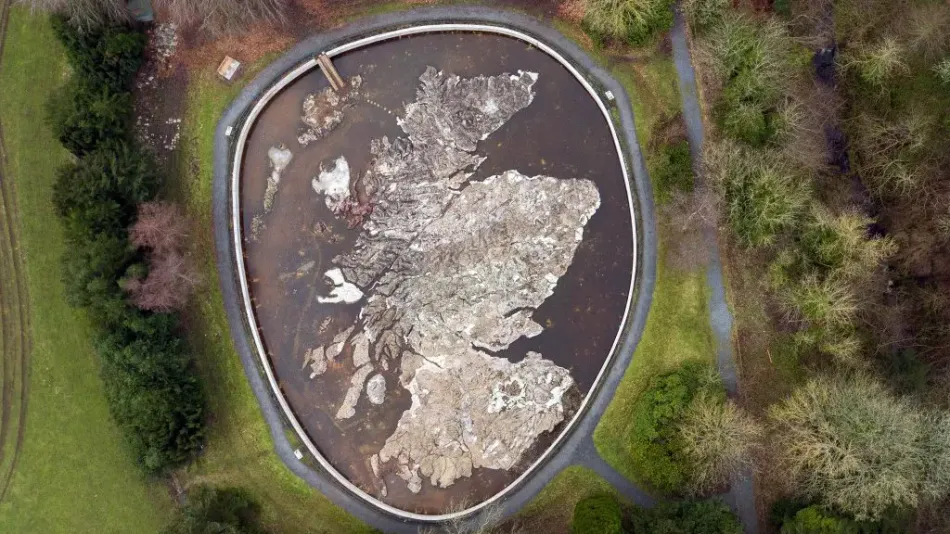
Ever wanted to walk across the entirety of the country? How about doing so on a smaller scale? The Great Polish Map of Scotland is a globally unique artwork in the Scottish Borders. It is a large man-made map of Scotland, sculpted from concrete and measuring a staggering 40m by 50m.
Where can I find The Great Polish Map of Scotland in the Scottish Borders?
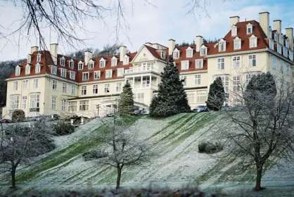
The Great Polish Map of Scotland is located on the grounds of the nearby Barony Castle, Eddleston, once the home of the Murrays of Elibank and now turned hotel. To get to the Hotel's grounds, visitors can head toward the local village of Eddleston and look for the first turn off opposite the Horseshoe Inn. From here drive 150 metres to the gates of Barony Castle Hotel and then follow the driveway to the car park.
The story of this geographical map began in 1926 when Barony Castle became a hotel. From 1942-to 1945 the hotel was used by the Polish Higher Military School and led a member of the school, Jan Tomasik, to buy the hotel in 1968. The construction of the map didn’t begin until 1974 and the bulk of the work was finished by 1976 until the addition of the basin of water surrounding the map which was dug out and created in 1979. With the map almost complete, Mapa Scotland was formed in 2010 and gained little traction. In 2012 the site was listed on Historic Scotland, which led to preparations for the restoration of the map to begin in 2013. With an addition of water, a perimeter fence and information panels in 2014, the map’s restoration continued until 2017 and is still standing strong today.
- 4 miles from the village of Eddleston.
- Access to the map is free.
- Barony Castle Hotel is located nearby for accommodation.
- For more information on how to get involved with Mapa Scotland, please visit their website.
 1 mile